A Western transportation hub
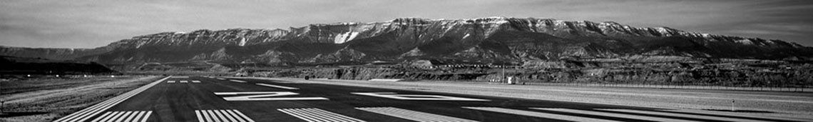
Garfield County Regional Airport (RIL)
Neighboring Eagle and Aspen airports are often closed due to weather, making Garfield County Regional Airport the preferred airport for private commercial business transport. With $7.5 million in upgrades from Garfield County and more than $39 million in overhaul and upgrades from the Federal Aviation Administration, Garfield County Regional Airport was upgraded by the FAA from B-11 to D-11 in airport safety ranking. The airport also offers Colorado’s first perfectly smooth, seamless runway, causing no jolts for landing aircraft. Open 24 hours a day, seven days a week, Garfield County Regional Airport is the preferred General Aviation Mountain Business Jet Airport in Colorado. Because the airport does not provide commercial travel, Federal Travel Security Travel regulations do not apply.
Garfield County Airport has created two separate parcels of land for hangar development. The first area contains nine new lease parcels that will accommodate large hangars of 100’x100’ or larger. A new taxiway, roads, water, sewer, and power define this area, specifically designed for heavy aircraft traffic up to 134,500 lbs gross landing weight.
The second area is available for development of smaller hangars, t-hangars, or shade hangars, designed for the smaller aircraft under 12,000 lbs gross landing weight.
Design Standards at Rifle airport
- Runway length 7,000′
- Runway width 100′
- Full parallel taxiway
- RSA width 300′ 500′
- RSA length 600′ 1,000′
- Runway OFA 600′ 800′
- Taxiway width 35′ 50′
- Lead-in to fillets 100′ 150′
- Fillet radius centerline 40′ 55′
- Visual slope indicators VASI PAPI
- Airfield lights MIRL HIRL
- Runway slope 1.2% .8%
- Approach lights: none
- ODALS IFR minimums 1588/5 1263/4

Photo credit: Ryan Mackley
Union Pacific
The historic Union Pacific Railroad dates back to 1867 in Colorado. Union Pacific operations are alive and well today, as Union Pacific commodity transfer frames the communities in the Colorado River Valley. Union Pacific operates a major network of east-west and north-south lines that carry freight to all parts of Union Pacific’s 23 state-system, a large portion of such running directly through Western Colorado. Amtrak also provides passenger service over the Union Pacific line, connecting Denver with California. Major commodities handled by Union Pacific in Colorado are grain, coal, automobiles, and consumer and manufactured goods. In the last two years, Union Pacific’s capital investment in Colorado was more than $120 million.
Amtrak
The National Railroad Passenger Association, Amtrak, has a healthy presence for regional, state, and national travel in Garfield County. RREDC communities are able to travel swiftly and frugally with two Amtrak train stations nearby. Glenwood Springs and Denver Amtrak stations provide daily departure and arrival for passengers wanting to utilize a safe, historic, and fast means of transportation to more than 500 of Amtrak’s destinations.
Roaring Fork Transit Authority (RFTA)
Named the “Best Mass Transit System in North America” by Mass Transit Magazine and awarded other top state and national transportation honors including “Large Transit Agency of the Year” by the Colorado Association of Transit Agencies, RFTA is Western Colorado’s biggest and best rural means of transportation. Running up and down the Roaring Fork and Colorado River Valleys, RFTA operates a fleet of over 82 vehicles and carried 4.1 million passengers in 2006. Additionally, RFTA reflects the region’s commitment to sustainability in the use of Biodiesel fuel and ethanol in their vehicles. RFTA allows for both ease and availability for much of Western Garfield County’s workforce to be mobile.
Healthy Highway Locale
Western Garfield County is situated with rare and convenient state and national highway and interstate access. Three major highways run either through or directly alongside communities in the Colorado River Valley.
I-70
The nation’s fifth-longest interstate, I-70, runs directly through Garfield County, and the section of I-70 that runs along Glenwood Canyon is considered an engineering marvel for its construction and surrounding landscape.
US Routes 6 & 24
In addition to having one of the nations’ main interstate routes frame the region, Western Garfield County also has U.S. Route 6 and U.S. Route 24 that support I-70 and connect the county’s south valley to northern cities and towns in Western Colorado. U.S. Route 6 also runs from western Utah to eastern Nebraska.
State Highway 13
Hwy 13 is yet another highway option for local communities. Hwy 13 has a central interchange south of Rifle which connects with I-70. The route then crosses the Colorado River and later intersects with U.S. Route 6 and U.S. 24. Running North to South, Hwy 13 connects to and provides easy access to the United States’ second longest interstate, I-80.